
SPDRRMO Successfully Conducts Five-Day Advanced Geographic Information System (GIS) Training on Spatial Analysis, Hazard Mapping, and Disaster Risk Management
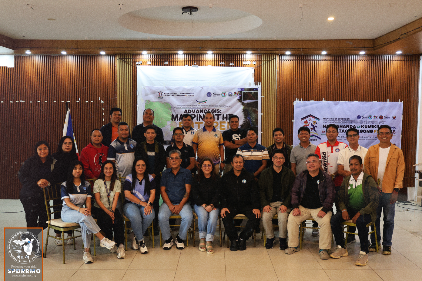
SORSOGON CITY, July 10, 2026 – In line with the nationwide observance of National Disaster Resilience Month (NDRM) 2026 with the theme “Naghahanda at Kumikilos Tungo sa Panatag na Bagong Pilipinas,” the Provincial Disaster Risk Reduction and Management Office (PDRRMO) of Sorsogon successfully concluded the Five-Day Advanced Geographic Information System (GIS) Training on Spatial Analysis, Hazard Mapping, and Disaster Risk Management, held from July 6 to 10, 2026, in partnership with the National Mapping and Resource Information Authority (NAMRIA).
The capacity-building initiative forms part of the Province’s continuing efforts to strengthen disaster preparedness and resilience by equipping disaster managers and technical personnel with advanced geospatial knowledge and analytical skills essential in risk-informed planning and decision-making. The activity likewise supports the objectives of National Disaster Resilience Month by promoting proactive disaster risk reduction measures and enhancing the capabilities of local government personnel in building safer and more resilient communities.
The specialized training brought together disaster risk reduction and management personnel, planners, technical staff, and GIS practitioners from the Provincial Government of Sorsogon and partner agencies to enhance their knowledge and technical competencies in the application of advanced GIS technologies for disaster risk reduction and climate resilience. Throughout the five-day course, participants were immersed in both theoretical discussions and hands-on practical exercises designed to strengthen their capabilities in spatial data processing, geospatial analysis, hazard mapping, and risk assessment.
The training featured comprehensive sessions on advanced GIS techniques, including spatial analysis, digital map creation, geodatabase management, remote sensing applications, terrain analysis, and the utilization of geospatial datasets for hazard identification and vulnerability assessment. Participants also developed hazard maps and conducted spatial modeling using actual local data, enabling them to better understand how geographic information can support evidence-based planning, emergency preparedness, and disaster response planning.
A highlight of the training was the expertise shared by resource persons from the National Mapping and Resource Information Authority (NAMRIA), who provided participants with the latest geospatial methodologies, national mapping standards, and best practices in utilizing GIS as a critical decision-support tool for disaster risk reduction and management. Their technical guidance reinforced the importance of accurate and reliable spatial information in strengthening disaster preparedness, mitigation, response, and recovery initiatives.
Provincial Disaster Risk Reduction and Management Officer Engr. Raden D Dimaano emphasized that investing in geospatial technologies and the continuous development of technical personnel remain a priority of the Provincial Government of Sorsogon. He underscored that enhancing GIS capabilities enables responders, planners, and decision-makers to generate accurate hazard maps, conduct comprehensive risk assessments, and formulate evidence-based strategies that ultimately protect lives, property, and the environment.
The successful conduct of the training reflects the Provincial Government of Sorsogon’s unwavering commitment to institutionalizing innovation, technology, and science-based approaches in disaster risk reduction and management. More importantly, it demonstrates the Province’s active participation in the observance of National Disaster Resilience Month 2026, reaffirming its commitment to the campaign theme, “Naghahanda at Kumikilos Tungo sa Panatag na Bagong Pilipinas.” Through initiatives such as this, the Province continues to strengthen the competencies of its workforce and foster a culture of preparedness, resilience, and sustainable development.
The Provincial Government of Sorsogon extends its sincere appreciation to the National Mapping and Resource Information Authority (NAMRIA) for its invaluable partnership, technical expertise, and unwavering support in making this capacity development initiative a success. This collaboration reinforces the shared commitment of both institutions to advancing geospatial innovation and strengthening local disaster resilience.
The training concluded with the awarding of Certificates of Completion to all participants, recognizing their dedication to advancing their technical expertise and reaffirming their commitment to applying Geographic Information System (GIS) technologies in promoting informed governance, effective disaster risk management, and resilient communities throughout the Province of Sorsogon.